The highest peak in Madeira is Pico Ruivo, at 1,862 metres, and the easiest way to stand on it is a walk of about an hour and a half from the Achada do Teixeira car park. Pico das Torres is second at 1,851 metres, but no ordinary path reaches its top. Pico do Areeiro, third at 1,818 metres, is the one you can drive to. Here they are in order, sorted by what a visitor can actually do with each.
In short
- Pico Ruivo (1,862 m) is the top of the island. Walk up from Achada do Teixeira on PR 1.2, or along the ridge from Pico do Areeiro on PR 1.
- Pico das Torres (1,851 m) is the jagged one in the middle of the ridge. You walk round it, not up it.
- Pico do Areeiro (1,818 m) has a road, a car park, a café and toilets at the top.
- Every walking route to the high peaks is a classified trail: book a slot and pay €4.50, or €10.50 for the full ridge (2026 prices).
- The top is cold, windy and often in cloud by late morning. Go early.
The high peaks by height
| Rank | Peak | Height | For a visitor |
|---|---|---|---|
| 1 | Pico Ruivo | 1,862 m | Walk: PR 1.2 from Achada do Teixeira, or PR 1 from Areeiro |
| 2 | Pico das Torres | 1,851 m | Seen from PR 1, which climbs round it |
| 3 | Pico do Areeiro | 1,818 m | Drive to the top |
| Pico do Cidrão | 1,802 m | Seen from the Areeiro, just to the west | |
| Pico do Gato | around 1,800 m | Seen from PR 1 | |
| Pico Grande | about 1,650 m | Unmarked climb from Boca da Corrida |
All of them belong to the same central massif, the old volcanic core of the island between Funchal and the north coast. On a clear day you can see each one from the others.
The one you drive to: Pico do Areeiro
The Pico do Arieiro viewpoint (you will see Areeiro and Arieiro both used) is the only one of the top three with a road to it. The road ends at a car park, and a five-minute walk takes you to the summit platform. There is a café and toilets.
People come for sunrise over a sea of cloud, and in summer the car park is full before dawn. The white dome by the summit is the Portuguese Air Force’s radar station, not an observatory. The sharp summit just to the west is Pico do Cidrão.
This is also where two classified trails start: the PR 1 ridge towards Pico Ruivo, and the fee-free PR 3 Vereda do Burro, a long descent towards Monte.
The ones you walk to
Pico Ruivo, the short way (PR 1.2)
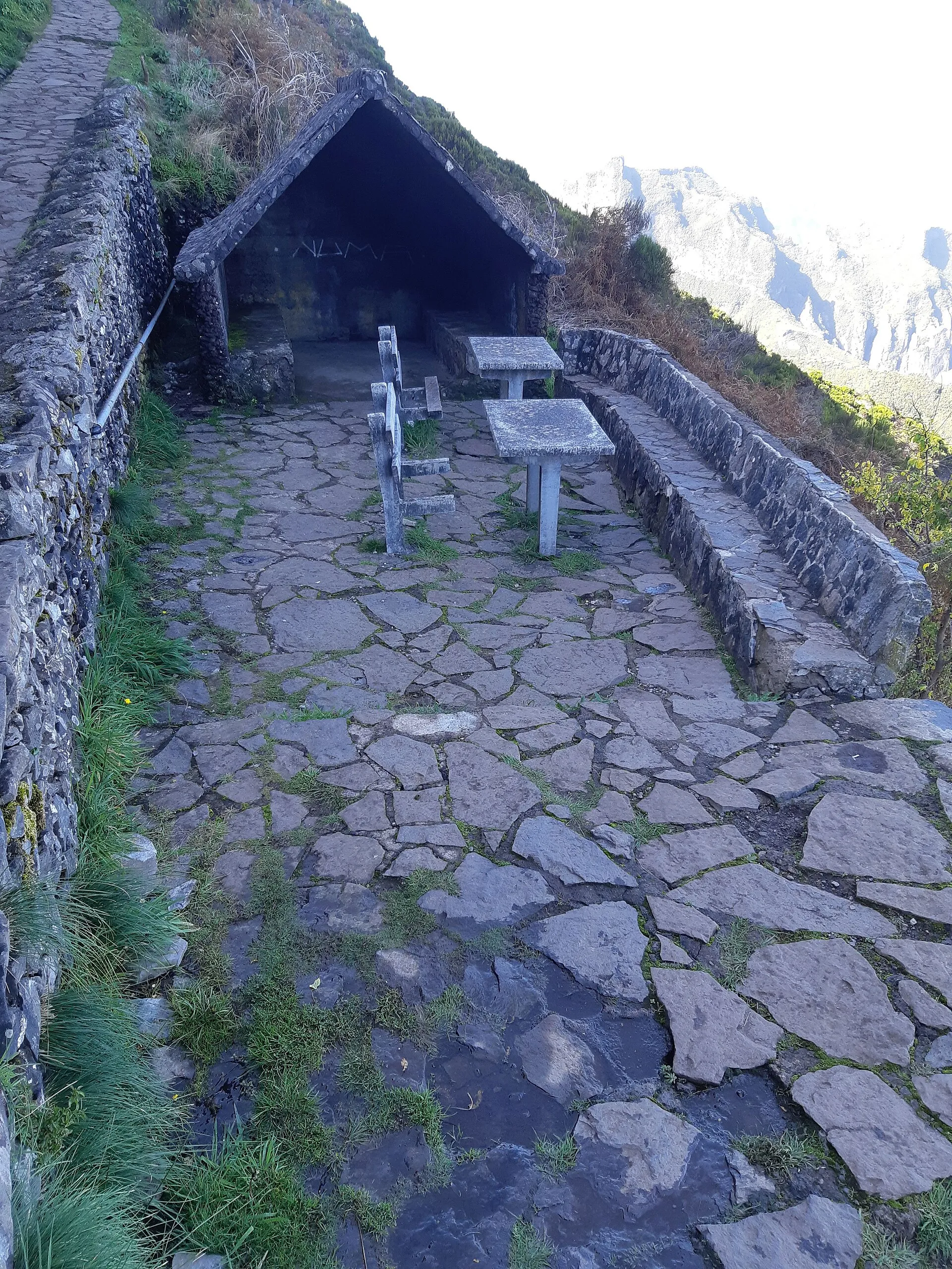
A road climbs from Santana to the car park at Achada do Teixeira, already at about 1,600 metres. From there PR 1.2 Vereda do Pico Ruivo is 2.8 km each way on a well-made path, with a few stone shelters along it for bad weather. Allow about an hour and a half up and a little less down. Near the top is the Casa de Abrigo, the Pico Ruivo mountain hut (do not count on it being open), and then a short final climb to the summit.
It is the route we would give almost anyone. The path is good the whole way, which is the main difference from the ridge. The top is exposed and the wind is sharp, so carry a warm layer even in August. Toilets at the car park. No bus: taxi from Santana or your own car. The ticket is €4.50 a person; under-13s are free.
Sunrise from Pico Ruivo draws a much smaller crowd than sunrise at Areeiro.
Pico Ruivo, the long way (PR 1)
The famous PR 1 Vereda do Areeiro runs 6.1 km from Pico do Areeiro to Pico Ruivo along the spine of the island, through tunnels and up stairs cut into the rock. The sign says three hours. Allow five.
It reopened in part on 1 May 2026 after works that had kept it shut since August 2024, and it runs under special rules. The first stretch, to the Pedra Rija viewpoint, is open in both directions, and everything beyond it is one way only, towards Pico Ruivo, on the western line through the tunnels (the eastern variant is closed). That one-way section was shut on 14 to 17 and 21 to 22 September 2026 to fit a boardwalk, and the IFCN table last updated on 14 September still shows it closed, so look at it before you book. So you finish at Pico Ruivo, carry on down PR 1.2 to Achada do Teixeira, and need a pre-booked taxi or a second car. The full-route ticket costs €10.50 and already covers that descent.
For a taste without the logistics, the Pedra Rija section is 1.2 km out from Areeiro and back, about an hour, for €4.50. That ticket stops at Pedra Rija.
Pico Ruivo from below: PR 1.1 and PR 1.3
Two more classified trails meet at the summit. PR 1.1 Vereda da Ilha drops more than 1,200 metres to the village of Ilha near Santana, 8.2 km of continuous descent that is hard on the knees. PR 1.3 Vereda da Encumeada heads west towards the Encumeada pass, but the section between Boca das Torrinhas and Encumeada is closed. Do not walk past the barrier.
Pico Grande
Lower than the others, at about 1,650 metres, Pico Grande is a great block of rock above Curral das Freiras, and the view from its top takes in the whole central massif. The usual approach follows the start of PR 12 Caminho Real da Encumeada from Boca da Corrida, then climbs off it on an unclassified path that is steep and scrambly near the top. PR 12 itself is open only for its first 3.5 km as of September 2026, so check the state of both before you go. This is one for experienced walkers on a clear, dry day.
The ones you only see
Pico das Torres. The second-highest peak is the most dramatic to look at: a cluster of tower-like crags halfway along the ridge. The PR 1 path does not cross its summit; it climbs round it on a steep staircase cut into the rock. There is no marked route to the top, and the rock is steep and loose. We would not try it, and we would not follow a stranger’s GPS track to try it either.
Pico do Gato. Further along the ridge from Areeiro, close to the PR 1 path. You will see the name on maps and signs rather than stand on it.
Pico do Cidrão. At 1,802 metres, the pointed summit just west of the Areeiro. The way up is steep and exposed, with a short rock climb at the end. Not a walk for visitors.
What the high peaks are like to be on
Cold. At 1,800 metres it is usually around ten degrees colder than Funchal, and standing still in the wind on a summit is colder again. Bring a warm layer and a windproof, whatever the forecast says for the coast.
Often cloudy. The peaks are usually clearest early. By late morning cloud often builds from below. Look at a summit webcam, not the Funchal forecast.
Closed in bad conditions. PR 1 closes in dangerous wind and for works, sometimes at short notice. Check the IFCN status the evening before.
Booked. Every walking route up here is a classified trail. Book a 30-minute entry slot on SIMplifica. You only get a refund or a new date if the IFCN closes the trail.
For packing for the heights, see weather and what to pack. For the roads up, driving in Madeira.
And on Porto Santo?
Madeira’s small neighbour is a much lower island. Its highest point is Pico do Facho, at about 517 metres, once a lookout where a fire warned of pirate ships. The walks visitors actually do are up the wooded Pico do Castelo and along the rock-cut path to Pico Branco and Terra Chã, the best walk on the island.
The Tropi Guide app has the ridge trails offline with your position, and tells you when a section closes.
Questions people ask
What is the highest peak in Madeira?
Pico Ruivo, at 1,862 metres. The easiest way up is PR 1.2 from the Achada do Teixeira car park above Santana, 2.8 km each way on a good path.
Can you drive to the top of a mountain in Madeira?
Yes, to Pico do Areeiro, the third highest at 1,818 metres. The road ends at a car park a few minutes' walk from the summit platform.
Can you climb Pico das Torres?
Not as a normal walk. The PR 1 ridge path goes round it on a staircase cut into the rock. The summit itself is steep, loose rock with no marked route.
Do I need to book to walk up Pico Ruivo?
Yes. PR 1.2 from Achada do Teixeira is a classified trail, so you book a 30-minute entry slot on SIMplifica and pay €4.50 per person in 2026. Children aged 12 and under are free but still need a place.
What is the highest point on Porto Santo?
Pico do Facho, at about 517 metres. Most visitors walk up the neighbouring Pico do Castelo or the Pico Branco path in the north-east instead.