11 places
Viewpoints
The miradouros worth stopping for, when the light is best, and which ones the cloud tends to hide.
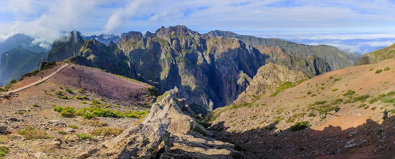 Above the Clouds
 Pico do Arieiro
Central · 1,818 m
You're standing on the third-highest peak in Madeira, and the only one you can reach with a steering wheel instead of your legs. Eighteen hundred and eighteen metres. Five minutes from the car park to the summit platform, and on the right morning you'll be looking down on the clouds: a soft white sea stretching to the horizon with the other peaks, Torres and Ruivo, breaking through it like dark islands. People go quiet up here. It does that to you. This is the roof of the island, and it's a different world from the coast you drove up from. It can be fifteen degrees colder, the air is thinner, and the weather turns on a coin, blue and blinding one minute, swallowed in cloud the next. That unpredictability is exactly why you come early: dawn is when the cloud inversion is most likely, and when the light sets the whole ridge on fire in pink and gold. Those white golf-ball domes near the top? An air-traffic radar station. You're at the literal high point of the island's road network. And that jagged path snaking away south toward Pico Ruivo is the legendary PR1 trail, three to four hours of stairs and tunnels carved along knife-edge cliffs. That one costs money and needs booking. This view costs you nothing but an early alarm. Local tip: check a Funchal webcam before you drive up in the dark. If the city's under cloud, there's a strong chance you'll be above it here, in the clear. Bring a proper jacket and gloves for sunrise; people show up in shorts and regret it instantly. The car park fills before dawn in summer, so go earlier than feels reasonable.
Read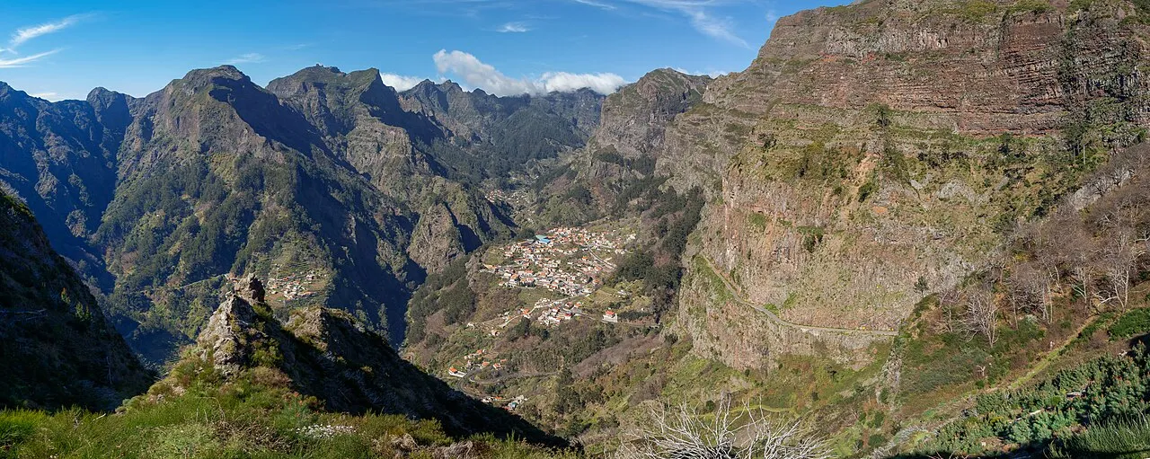 The Valley of the Nuns
 Eira do Serrado
Central · 1,095 m
Park by the gift shop, walk two minutes up a stone path, and the ground simply falls away. Below you, ringed by towering peaks on every single side, sits a tiny village at the bottom of what looks exactly like a volcanic crater: Curral das Freiras, the pen of the nuns. The name isn't decoration. In 1566, when French pirates sacked Funchal, the nuns of the Santa Clara convent grabbed what they could and fled up into these mountains, hiding in this near-unreachable valley. For centuries the only way in or out was a steep footpath down the cliffs. There was no road until the twentieth century. Imagine carrying everything you owned down into that. Today the village is famous for two things grown in the valley: sweet chestnuts and a cherry-and-chestnut liqueur that'll warm you from the inside. Stand at the railing and take in the sheer scale of it: the walls, the drop, the houses like grains of rice at the bottom. Then, if you've got time, drive down into the crater itself. The road that gets you there is half the adventure, and the view up from the bottom is just as good as the view down. Local tip: go in the morning. By afternoon the valley fills with haze and the peaks vanish. The little path to the true viewpoint is past the gift shop, not the first railing most people stop at; walk the extra three minutes for the real thing.
Read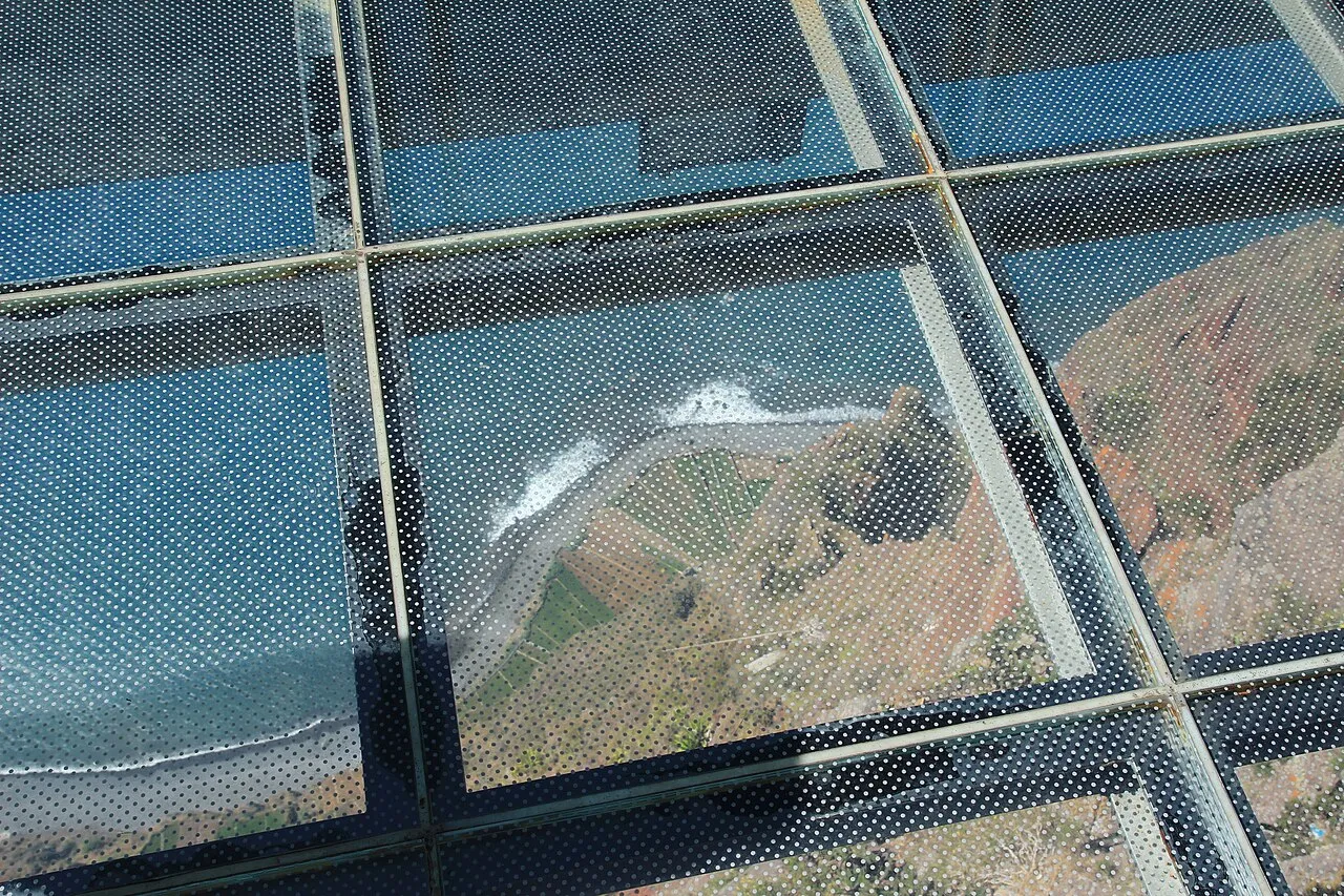 One of Europe's Highest Sea Cliffs
 Cabo Girão Skywalk
South-west · 580 m
Five hundred and eighty metres of straight down, and a glass floor to make sure you feel every one of them. Cabo Girão is one of the highest sea cliffs in Europe, and someone had the nerve to bolt a transparent platform onto the very lip of it. Walk out, look down through your own feet, and watch the Atlantic crawl against the rocks far, far below. Some people freeze halfway and can't take the last step. No shame in it. That's the whole point. Now look down and slightly inland, to those tiny green rectangles at the very base of the cliff, right at the waterline. Those are the fajãs: patches of farmland on the narrow strip between cliff and sea. Until 2003 the farmers who worked them could only get down by boat. They grew vines and bananas on the most inaccessible plots imaginable, generation after generation, because flat fertile land on this island is precious enough to risk your neck for. Now a cable car drops down to them, and almost nobody rides it, which makes it one of the most surreal, empty corners of Madeira. The name Girão (to turn) comes from the legend that Zarco turned his ship around right here on his first scouting trip along the coast. He went back. You won't. Local tip: this is on every bus tour's list, so timing is everything: get here before 10:30 or after 16:00 and you'll have room to breathe. Since January 2026 the skywalk costs €5 for visitors (free for residents and children up to twelve), paid at the entrance.
Read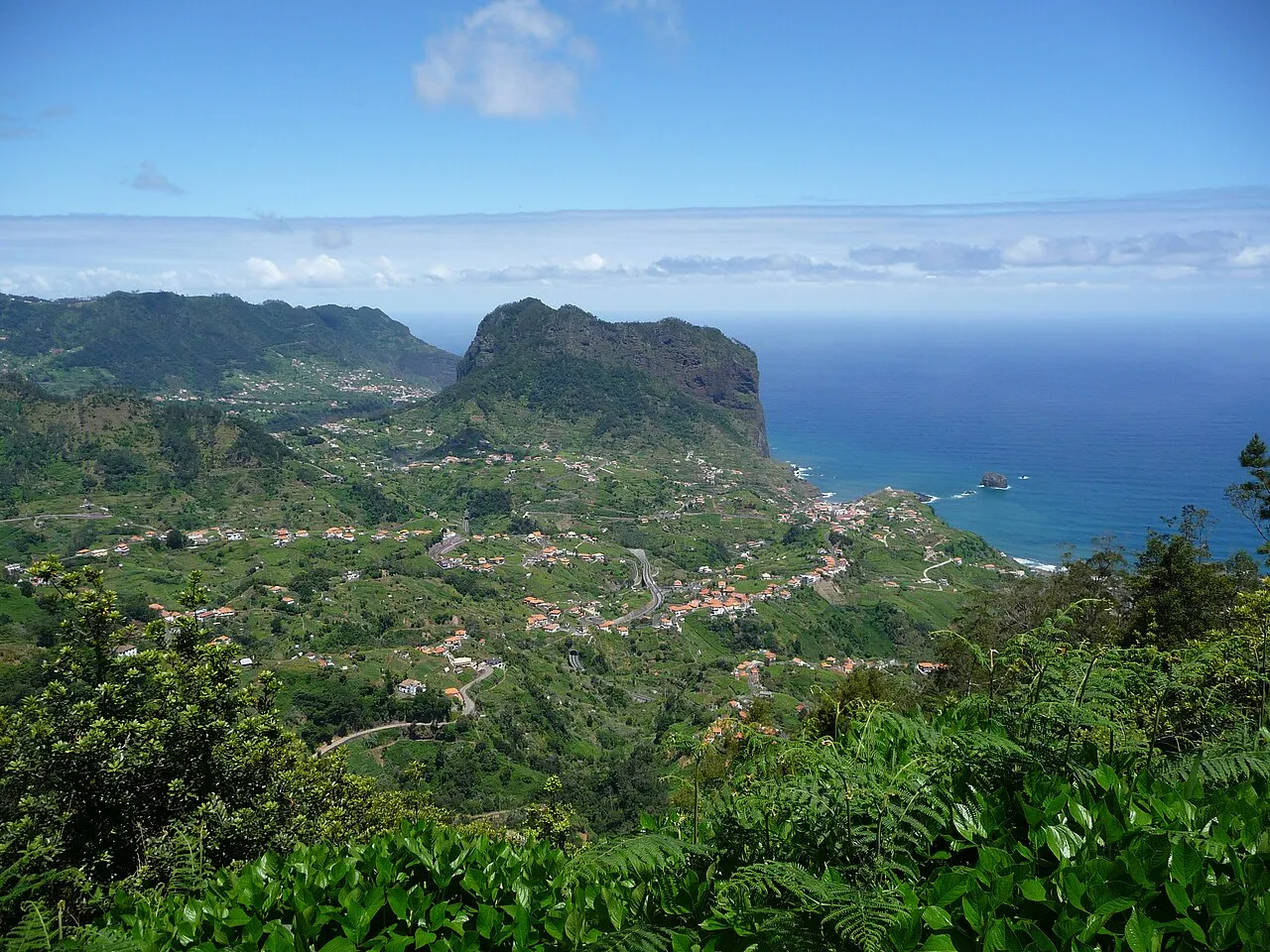 The North-Coast Balcony
 Miradouro do Guindaste
North · Faial
If the south coast is Madeira's polished side, the north is where the island shows its raw, dramatic face, and the Guindaste viewpoint is your front-row seat. Bolted onto the cliffs above the Foz da Ribeira do Faial, this platform pushes you out over the open north Atlantic, with nothing between you and the horizon but air and seabirds. Below, the ocean batters black volcanic rock; there's no gentle beach here, just power. And rising out of the sea to your side is the Penha de Águia (Eagle Rock), a colossal 590-metre monolith that splits the coast in two and dominates everything around it. Locals named it for the ospreys that once nested on its cliffs. This is a completely different island from the sunny banana slopes around Funchal: greener, wilder, wetter, with waves that draw surfers to nearby Porto da Cruz. Stand here for five minutes and you'll understand why the north has its own character, its own pace, and, soon enough, its own tour. This is just the trailer. Local tip: mornings tend to be clearest; the north coast catches cloud and rain more than the south, so a bad-weather day in Funchal can still be fine here, or the other way round. The lower platform has the best angle on Eagle Rock. Take the steps down.
Read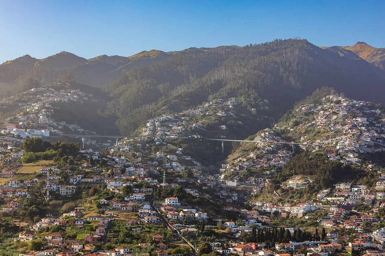 Funchal From Above
 Pico dos Barcelos
Funchal · 355 m
Five minutes from the centre of Funchal, and suddenly the whole city is laid out below you like a model. The harbour, the cruise ships, the amphitheatre of white houses climbing the hillsides, and behind it all the mountains rising into the clouds. This is the orientation stop: do it on your first evening and the rest of the island will make more sense. Funchal got its name from funcho, the wild fennel that covered this valley when the Portuguese arrived in 1419. From up here you can read the city's whole geography: the way it spills down a natural bowl to the sea, the old town clustered to the east, the hotels to the west, and the green terraces wedged into every spare slope. For five hundred years people built wherever the mountain let them. Come at dusk. As the light drops, the city switches on below you, the harbour glitters, and the cruise ships light up like floating towns. It's the kind of view people pay for from rooftop bars, and here it's free, with a fraction of the crowd. Local tip: sunset and the half-hour after are the magic window. Daytime is fine but the lights are the real show. It's an easy, quick stop to pair with dinner up in the hills.
Read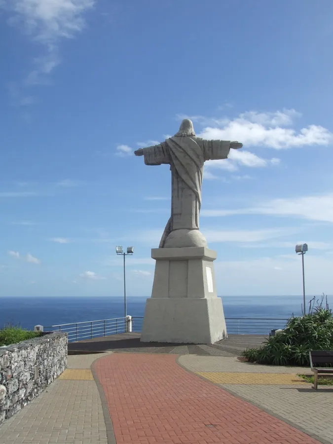 The Christ Over the Sea
 Cristo Rei do Garajau
Caniço · East of Funchal
Standing on this headland east of Funchal, arms open to the Atlantic, is a statue of Christ the King, and here's the fact to save for dinner: it's older than the famous one in Rio de Janeiro. Garajau's Christ went up in 1927; Rio's came four years later, in 1931. The little island in the Atlantic beat Brazil to the icon. But the real treasure here is underwater. The sea below the statue is the Garajau Marine Reserve, one of the first protected marine areas in Portugal. Because fishing has been banned here for decades, the water teems with life: big groupers that come right up to divers, shoals of fish, rays. Snorkellers and scuba divers come from all over for water this clear and this alive. There's a cable car that drops down the cliff to a pebble beach at the bottom if you want to get in. Up top, the view runs the whole coast (Funchal to the west, the airport headland to the east), and the breeze off the ocean is the kind that resets your head. It's a quiet, slightly solemn spot, and a perfect gateway as you point yourself east. Local tip: if you've got swimming gear, the cable car down to Reis Magos and the reserve beach is worth it. The snorkelling right off the rocks is some of the best near Funchal. Sunrise here, with the statue lit by the first sun, is special and empty.
Read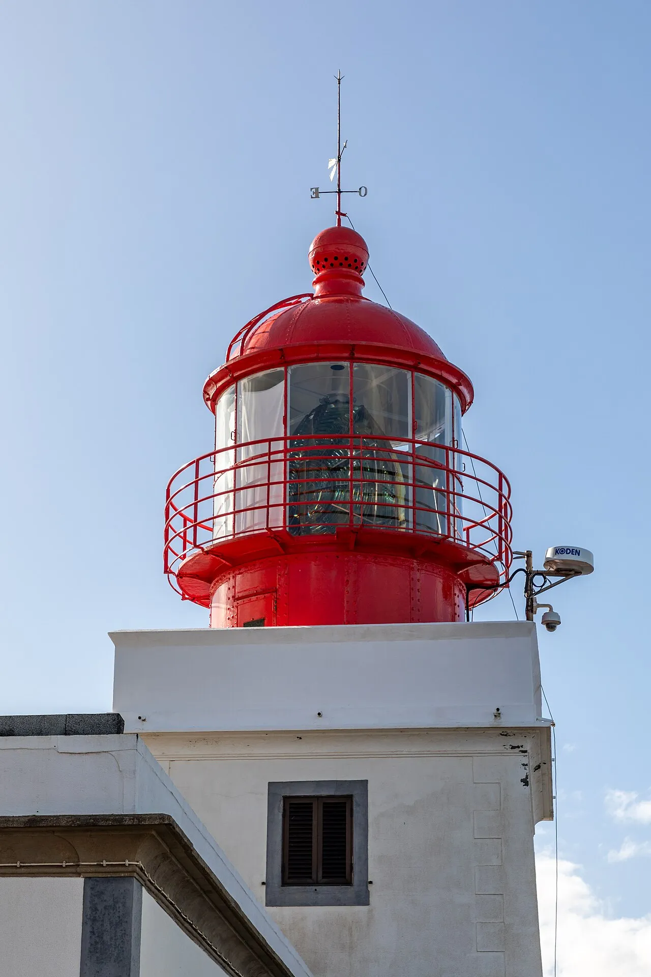 Land's End
 Miradouro da Ponta do Pargo
West tip · 300 m
This is the westernmost point of Madeira, and it feels like it. A lighthouse stands on a cliff nearly 300 metres above the sea (one of the highest lighthouses in Portugal measured from the water), and around it the land just runs out. Green meadows roll to the edge, cows graze right at the lip of the drop as if the precipice were nothing, and beyond the cliff there is nothing at all: open Atlantic, all the way to America. They call it Pargo after a giant fish, a sea bream, supposedly caught here back in Zarco's day. It's the kind of half-legend that sticks to every corner of this island. The little viewpoint has a shelter and a path to the edge; walk out, and on one side you'll see the wild north coast curling away, on the other the sunnier south you probably drove up from. And then there's the reason most people in the know come here: the sunset. With no competition for the title, this is the best place on Madeira to watch the sun drop into the ocean. The whole sky goes copper, the lighthouse starts its sweep, and for a few minutes you're standing at the quiet end of the world. Local tip: time your whole west day to end here at sunset. Bring a layer; the wind picks up the moment the sun's down. Cows have right of way on the approach road, genuinely.
Read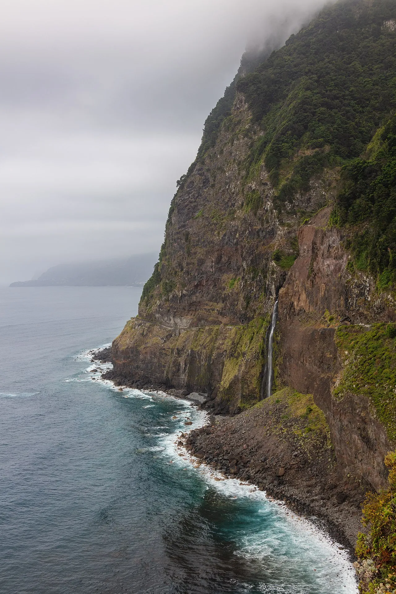 The Bride's Veil
 Miradouro do Véu da Noiva
Seixal · North-west
Pull off the old north-coast road here and look back at the cliffs: a waterfall spilling hundreds of metres down sheer black rock straight toward the sea, fanning out as it falls. They call it the Véu da Noiva (the Bride's Veil), and on a windy day you'll see exactly why, as the wind catches the water and lifts it sideways into a drifting white trail. This stretch of coast is one of the most dramatic drives on the whole island. The original road here was carved by hand into the cliff face, with waterfalls that literally fell onto the tarmac and tunnels dripping overhead, a piece of engineering madness that took decades. Most of that old road is bypassed now by tunnels, which is safer but means you have to choose to stop at the viewpoints like this one to feel it. Across the water you can take in the rugged Seixal coastline, with its vineyards somehow clinging to the cliffs above black-sand coves. This is the Madeira from before mass tourism: raw, vertical, and a little bit unbelievable. Local tip: the waterfall is fullest and most spectacular after rain, and the north coast gets plenty of it. There's a small platform for the photo; the light is best in the late afternoon when the sun comes round to the west.
Read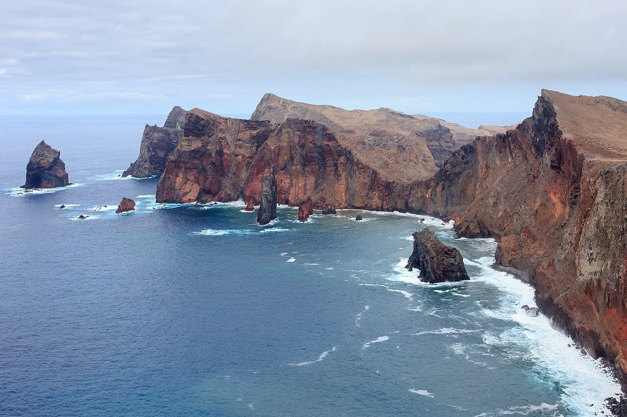 Cliffs Between Two Seas
 Miradouro da Ponta do Rosto
East tip · Caniçal
This is the detour almost everyone skips on the way to the São Lourenço trailhead, and almost everyone should make it. Pull off, walk to the edge, and hold onto your hat, because the wind out here on the eastern tip is a force of its own. What stops you is the colour. The cliffs drop straight into the north Atlantic in bands of rust, ochre and deep red. That's iron in the volcanic rock, five million years old, slowly oxidising in the salt air. This is the oldest land in Madeira, the part that came up out of the sea first, and it's been scoured by the wind down to its bare bones. No trees, no green, no shade: just raw geology and two oceans. Look out to the horizon. On a clear day, that low golden shape in the distance is Porto Santo, Madeira's little sister island, the one blessed with the nine kilometres of soft beach this island never got. Below you, the colours of the rock against the two different blues of the sea look almost edited. They're not. This is the real, unfiltered end of the island. Local tip: genuinely mind the wind here: it can shove you, and the edges are unguarded in places, so keep back and keep children close. Morning light makes the red rock glow, and it's calmer before the afternoon wind builds.
Read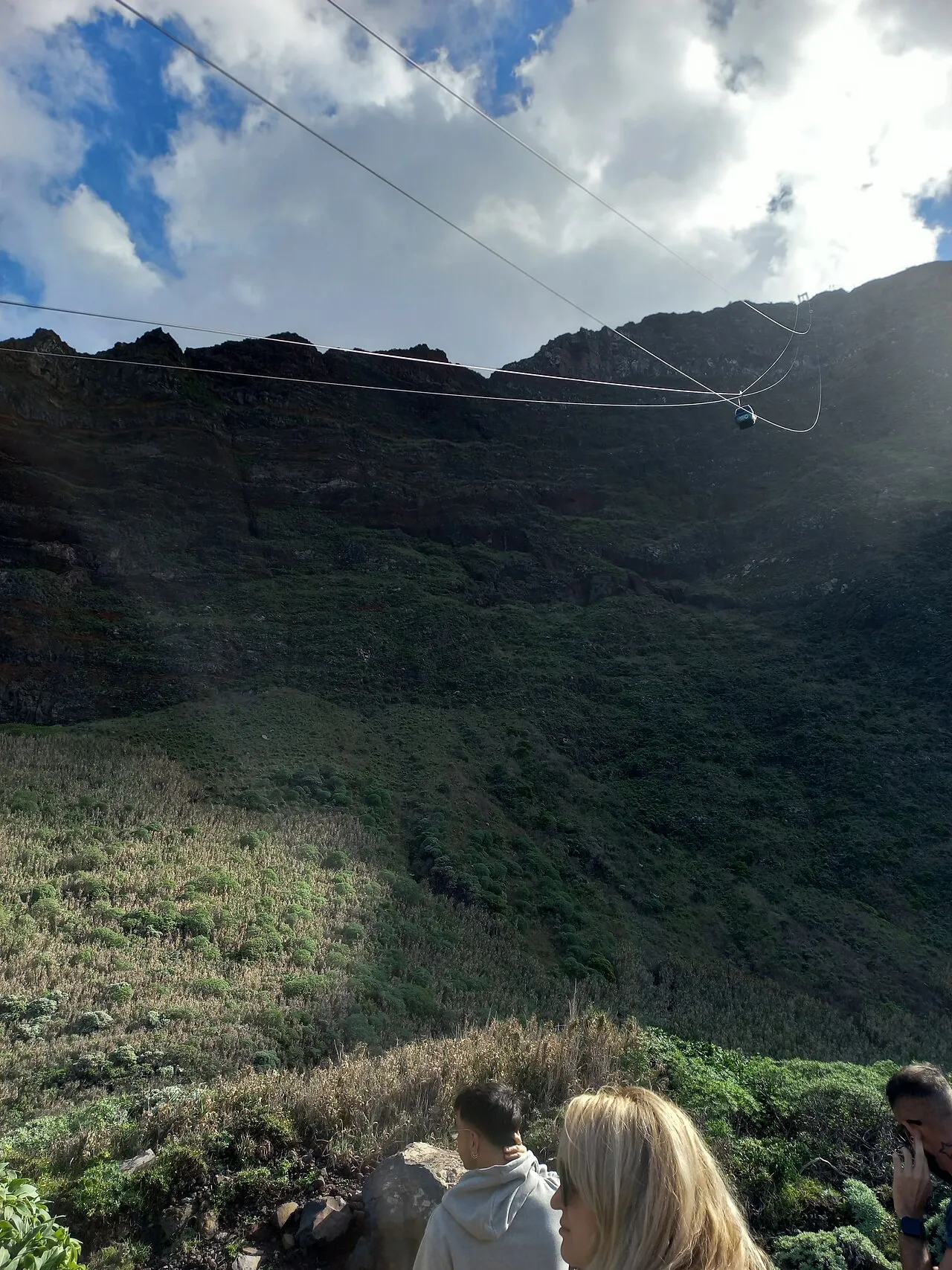 The Steepest Cable Car in Europe
 Achadas da Cruz
North-west · 450 m
The viewpoint here is free and stunning on its own, a clifftop balcony over the wild north-west coast, with a tiny patchwork of green fields impossibly far below at the waterline. But the real story is how the people down there get to those fields. This is the Achadas da Cruz cable car, and it is claimed to be the steepest in Europe, a 98 per cent gradient, dropping 450 metres down a near-vertical cliff face in about five minutes. It wasn't built for tourists. It was built so the farmers of the Fajã da Quebrada Nova, the sliver of farmland at the bottom, could get themselves and their crops up and down without risking a deadly climb. Before it, that was an hour-plus scramble down a cliff with a basket on your back. Stand at the top and just take in the audacity of it: a working farm clinging to the sea at the foot of a wall of rock, reached by a cabin that feels like it's going straight down. A return ticket is about five euros if you want to ride it; the view from the top costs nothing. Either way, this is the Madeira that flat-land countries can't imagine: a place where people farmed the unfarmable, and built a clever little miracle to make it possible. Local tip: check the cable car's hours and that it's running before you make the long drive out. It pauses at midday and stops for wind. Even if it's closed, the clifftop viewpoint alone is worth the detour. Pair it with Porto Moniz or Ponta do Pargo; they're all in the same north-west corner.
Read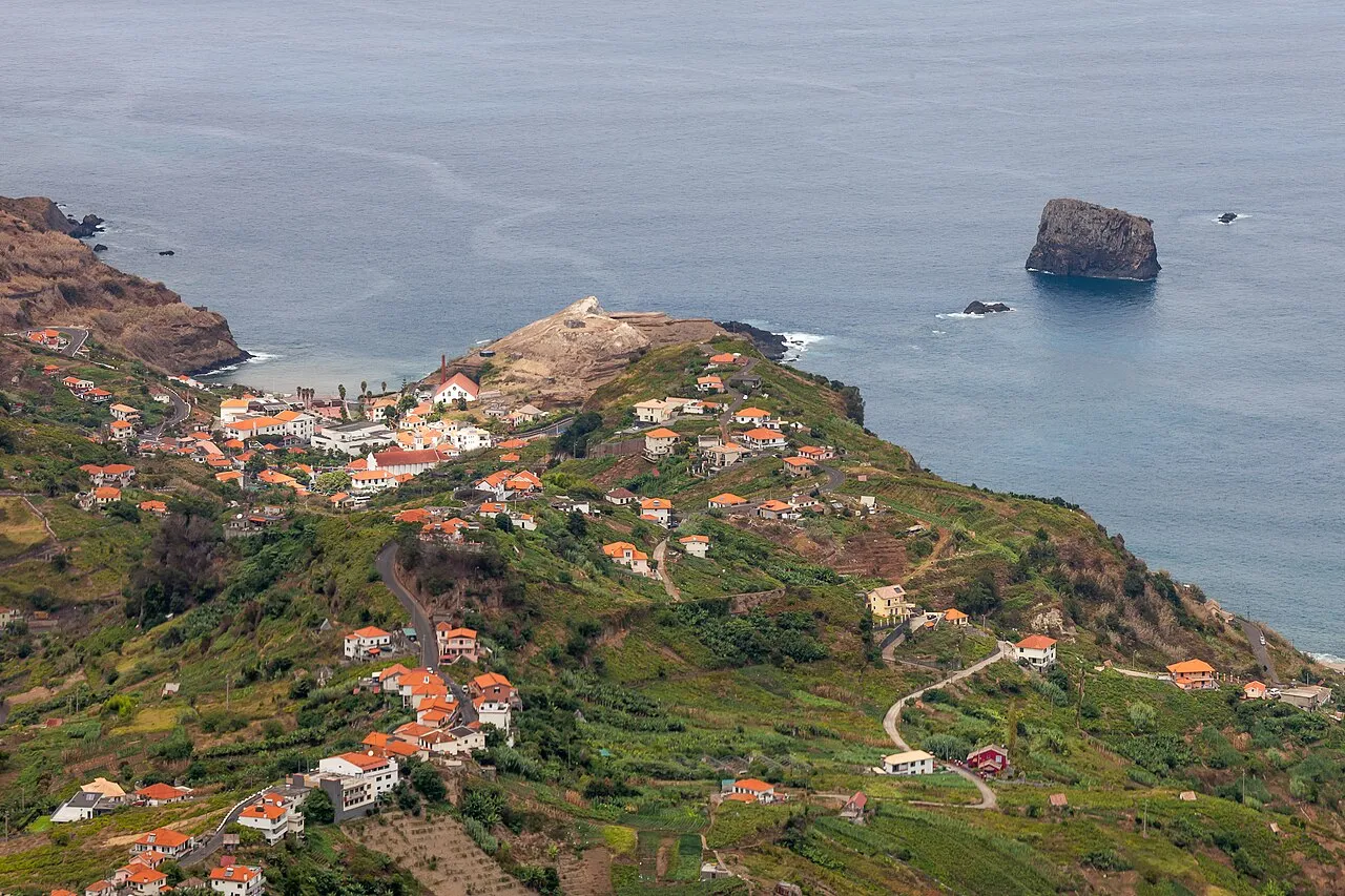 The Gateway to the North
 Portela
East–north pass · 660 m
Portela is a mountain pass, the saddle where the road crosses from the dry, sunny east of the island over to the green, wet north. And because it's the hinge between two very different Madeiras, the view from here is one of the most rewarding on the island for the least effort: just pull over at the café and turn around. Below you, the north coast opens up: the town of Porto da Cruz tucked against the sea, terraced vineyards stitched into impossibly steep slopes, and dominating it all, the enormous bulk of the Penha de Águia (Eagle Rock) rising 590 metres sheer out of the Atlantic. On a clear day the whole scene looks staged. This pass has been the crossing point for centuries: farmers, ox-carts, traders moving between the two coasts. There's a reason there's an old café right here: this is where you stop, catch your breath, and take in how abruptly the island changes character from one side of a ridge to the other. Local tip: grab a coffee (or a poncha if you're not driving) at the old café and use the terrace for the view. It's the perfect halfway pause on a scenic loop back from the east, and the light on Eagle Rock is best in the morning.
Read