You can do Madeira with a browser, a weather app and Google Maps. But a few more apps save real trouble: a closed trail you would have driven an hour to reach, a bus that no longer runs at 18:00, a phone with no signal at the one junction where the levada splits. Here is what to install, sorted by the job it does, with what each app is bad at too.
In short
- Trails: book on SIMplifica (in the browser, no app), then check the trail’s status the same morning on the IFCN or Visit Madeira page, or in an app that shows it.
- Weather: the official Meteo IPMA app for warnings, Windy to compare models, and a live webcam before you drive up a mountain.
- Maps offline: download Madeira in Google Maps for driving, and get Organic Maps (free) for walking.
- Rides: Bolt and Uber both work, mostly around Funchal and the airport. Taxis are still the backup.
- Safety: ProCiv Madeira, the regional civil protection app, sends your position with an emergency call and lists closed roads and footpaths.
Prices and features below are from each app’s own store page or website, checked in October 2026. Stores change things often, so look again before you pay.
Hiking: bookings, trail status and route apps
This is where the right app matters most, because three things change from day to day: your slot, the trail’s status, and the signal you will have to follow it.
SIMplifica: the booking, and no app to download
Every official PR trail needs a booked 30-minute entry slot before you walk. The only way to book is SIMplifica, the regional government’s online portal. You need an account, and everyone in the group goes on the booking. There is no SIMplifica app; it runs in your phone’s browser.
- Good: it is the only real ticket. Nothing else counts at a check.
- Bad: you need signal to buy, and the trailheads often have none. Book before you leave the hotel and screenshot the ticket.
The whole process, with the fees and the refund rules, is in our trail reservations guide.
Trail status: IFCN, Visit Madeira, or an app that reads them
A trail can close overnight after rain or a rockfall, and a closed trail is still closed if you already paid for your slot. Two official sources publish the status:
- The IFCN page (the forestry institute that runs the trails) has the status table.
- Visit Madeira’s hiking page marks each trail Open, Restricted or Closed, and says status can change with weather or safety.
They do not always agree. On 1 October 2026 the IFCN listed PR 8 as open while Visit Madeira listed it as restricted with temporary diversions. When they differ, read both notes before you drive.
Our open today page gathers the status of every official trail in one list, so you do not have to open both every morning.
Route apps for the walk itself
| App | Price model | Good at | Bad at |
|---|---|---|---|
| WalkMe, Walking in Madeira | Free, first trail free; paid plans and passes unlock the rest | 50+ Madeira trails with descriptions and photos; offline GPS navigation; alerts for closures and weather | Offline navigation only in the paid plan; English only; one 2024 review found walks shown open after wildfires had closed them |
| MadeiraTrails | Free, with a monthly premium or a lifetime licence | 39 hand-picked Madeira routes (per its latest notes); offline maps | English only; its listing says nothing about trail status or bookings |
| AllTrails | Free; Plus and Peak are subscriptions | Offline maps, wrong-turn alerts and live sharing, all in Plus | The free version needs signal to be much use; not built for Madeira, so local rules and closures are not its job |
| Komoot | Free; first region free, then regions, a World Pack or Premium | Good route planning; your first region is free forever, which can be Madeira | Offline maps elsewhere cost money; same caveat on local closures |
A Madeira app knows the PR numbers and the local quirks. A global app is better if you already use it at home and have your settings and recordings there. Neither replaces the official status page, and none of them sells you the SIMplifica slot.
Weather and webcams
Madeira’s weather is local. Funchal can be in sun while Pico do Arieiro sits in cloud, and the north coast can be wet while the south is dry. So you want two things: an official forecast with warnings, and a way to see what the mountain looks like right now.
| App | Price model | Good at | Bad at |
|---|---|---|---|
| Meteo IPMA | Free | The official Portuguese weather service: warnings, a 10-day forecast (hourly to day 3), sea state, UV; over 300 places in Portugal; English and Portuguese | A forecast for a place, not for a ridge or a valley |
| Windy | Free; Windy Premium paid | 15+ weather models to compare, wind and cloud maps, a webcam layer (67,000+ worldwide) | Many layers to learn; the most frequent updates are in Premium |
What actually decides a mountain morning is a live picture. A forecast saying “partly cloudy” can mean a sea of cloud below you at Arieiro or a wall of fog in your face. Look at a webcam before you leave, and again before the last climb if you can. Our weather and packing page covers what to bring for both.
Maps that work without signal
Madeira has good mobile coverage on the coast and in the towns. It gets patchy in the deep valleys, in the laurel forest, on the plateau and inside the long road tunnels. Download before you need it.
Google Maps is fine for driving if you download the island first. Two limits: driving directions work offline only if the whole route is inside the downloaded area, and walking, cycling and bus directions do not work offline at all. Offline maps also expire, so let them update on Wi-Fi.
Organic Maps is free, has no ads and no tracking, and every feature works offline. It is built on OpenStreetMap, so it shows hiking paths, contour lines and elevation profiles. It is our pick for a free offline map on foot. It has no trail status and no notes about what is closed.
If you are hiring a car, the car hire guide has the rest of what to sort out before you set off.
Buses, Bolt, Uber and taxis
Buses
Madeira’s buses are run by more than one company, and there is no single official app covering all of them.
- Horários do Funchal (the city and nearby buses) has a trip planner on its website and publishes its routes on Google Maps, Moovit and HERE WeGo. Tickets go on the GIRO card.
- SIGA (siga.madeira.gov.pt) is the regional public transport site, with timetables, a trip planner and the Aerobus.
- Madeira Bus is an independent app (it says plainly that it is not the official SIGA app) with timetables for Horários do Funchal, CAM, Rodoeste, the Aerobus and the Porto Santo ferry. The core timetables work offline for free; passes unlock more. It does not sell tickets.
Bus lines were renumbered in 2026. If a blog or an old screenshot gives you a bus number, check it against a current timetable.
Bolt and Uber
Both work in Madeira. Uber left in 2021 when the region capped ride-hailing cars, and started again in December 2024 after the cap was struck down in court. Bolt has stayed throughout.
- Bolt picks up at the airport, with normal, XL and hybrid or electric cars, and can also call an ordinary local taxi through the app. You see the price before you book.
- Uber lists pickups at the airport too.
Both are at their best in Funchal and around the airport. In the villages, on the north coast or at a trailhead, expect to wait or find nothing. Do not plan a one-way walk on the hope of a ride at the far end: book a taxi before you go, or check the bus.
Taxis
Funchal’s taxis wait at ranks around the centre. For a trailhead pickup at a fixed time, a taxi booked the day before is still the most reliable way.
Safety: one app worth having
ProCiv Madeira is free and comes from the region’s civil protection service. Its main job: an emergency call that sends your position and profile to the rescue services alongside 112 (with GPS and data on). It also shows IPMA weather warnings, civil protection alerts, and closed roads and footpaths. Its listing names four languages including English, but one reviewer found much of it only in Portuguese.
Install it, open it once at the hotel, and you will probably never need it again. On a mountain path in fog, it is the one you will be glad of. Our staying safe page has the rest.
What am I looking at? Audio tours
Driving the island, you pass churches, terraces, old roads and whole villages with a story behind them, and nothing at the roadside tells it. That is what a GPS audio tour does: it plays the story as you arrive.
Tropi Guide Madeira is ours, so weigh that. Here is what it does and does not do:
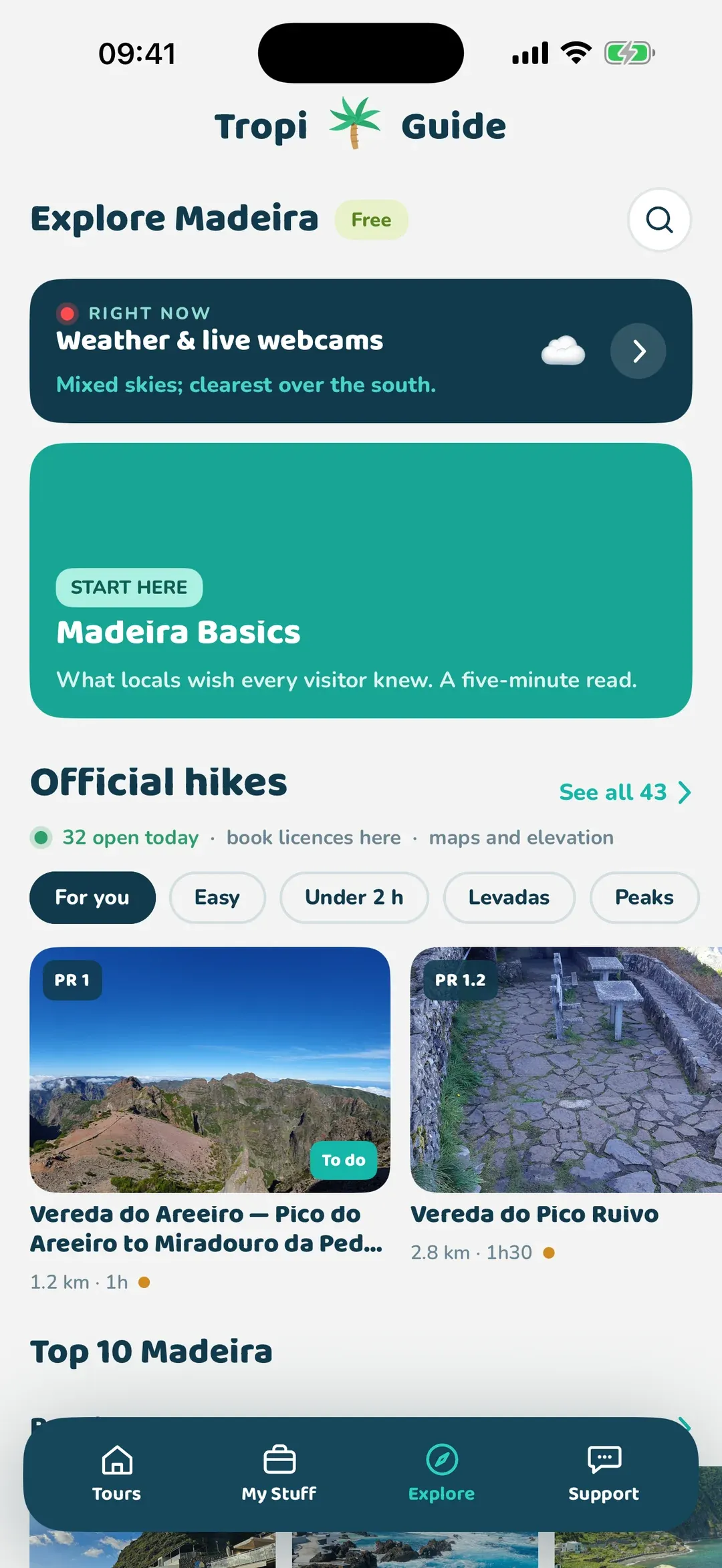
- What it does: GPS audio tours that start by themselves at each stop and work offline once downloaded. There are 5 driving tours and 2 walking tours in Funchal, listed on our tours page. The app also shows the daily status of all 43 official trails with free licence slots, and a free guide to beaches, waterfalls, viewpoints, the weather and live webcams.
- What it does not do: it is on iPhone only for now (Android is coming). Narration is in English. The tours are paid, each with free samples to listen to first; the trail status and the place guide are free. It does not book your SIMplifica slot and it is not a step-by-step trail navigator.
How it works in the car, and what happens without signal, is on our how it works page. If you would rather have a person, a guided tour or a local driver tells you more and answers questions; you trade that for your own pace and timetable.
Food
Honestly, you do not need a food app here. Google Maps shows opening hours, menus in photos and recent reviews, which is most of what you need. What trips visitors up is timing: some restaurants close one day a week, and Sundays and holidays change hours (see Sundays, holidays and opening hours). Check the listing the day before you drive somewhere for lunch.
For what to order, see what to eat and drink and the dishes guide, Madeira dishes to try.
The short list
If you only install five things before you fly:
- Organic Maps, with Madeira downloaded.
- Meteo IPMA for the forecast and warnings.
- ProCiv Madeira for emergencies and closed paths.
- Bolt or Uber, whichever you already have an account on.
- One trail app, and a bookmark to SIMplifica in your browser.
Then, the morning of a walk, check the trail is open on the official pages or on our open today list before you drive.
Questions people ask
Is there Uber in Madeira?
Yes, again. Uber left in 2021 and started again in December 2024. Bolt also works, and its app can call an ordinary local taxi too. Funchal has the most cars; out in the villages you may wait or find nothing, so a taxi rank or a phone call is the backup.
Do I need an app to book the hiking trails in Madeira?
You need SIMplifica, the regional government's booking portal, but it runs in your phone's browser. Every official PR trail needs a booked 30-minute entry slot, paid online, before you walk. Screenshot the ticket, because signal at the trailheads is poor.
Which weather app is most accurate for Madeira?
Use the official Meteo IPMA app for warnings and the town forecast, and Windy to compare models and see the cloud. Neither can promise what a ridge at 1,800 m will do, so look at a live webcam before you drive up.
Does Google Maps work offline in Madeira?
For driving, yes, if you download the area first and your whole route is inside it. Walking and bus directions do not work offline, and the trails are not on it in any useful way. For walking, use an offline hiking map such as Organic Maps or a trail app.
What is the best offline map for levada walks?
Organic Maps is free, works fully offline and shows hiking paths. WalkMe and MadeiraTrails add written trail guides, with offline navigation in their paid plans. Whatever you use, check the trail's official status the same morning.