The three mistakes that cost first-time visitors a day in Madeira are planning the island as if it were flat, choosing a walk because of a photograph, and trusting one forecast for a place with weather at every altitude. None of them needs local knowledge to fix, only a few minutes before you set off.
In short
- One region per day. On paper the island is 57 km long; on the road it is tunnels, hairpins and car parks that fill by nine.
- Before any walk, find out four things: the licence, the exposure, the tunnels and where it ends.
- The weather depends on height and coast. Check a live webcam of the exact place, not the forecast for “Madeira”.
Mistake 1: treating the island as a flat map
Madeira is about 57 km from end to end and 22 km across. People see those numbers and plan a loop: the west coast, the north coast, the eastern tip, back for dinner.
What they find is a mountain range with a road network drilled through it. There are well over a hundred road tunnels, the longest a little over 3 km, and where there is no tunnel the road climbs in hairpins. The expressway along the south coast is fast. Leave it, for the peaks, the north coast or the villages under the western cliffs, and a few kilometres on the map can take the best part of an hour.
So the loop day goes like this. You leave at eight, spend the morning between tunnels, reach Porto Moniz as the pools are closing and the mountains after the cloud has come down, and remember the day as a windscreen.
The fix: one region per day. West one day, east the next, the north on another, with room in each for the stop you did not plan: a café in a village, a swim, a viewpoint nobody mentioned. If the trip is short, see fewer places properly. Two things to know on top: the ER 105 over the mountains from Encumeada to Rabaçal has been shut since January 2024, so Rabaçal is reached the long way, from Calheta; and car parks at Pico do Areeiro, Baía d’Abra and Rabaçal fill early in season, which is a second reason to give each area a full morning. Driving in Madeira covers the roads themselves.
Mistake 2: choosing a walk by its photo
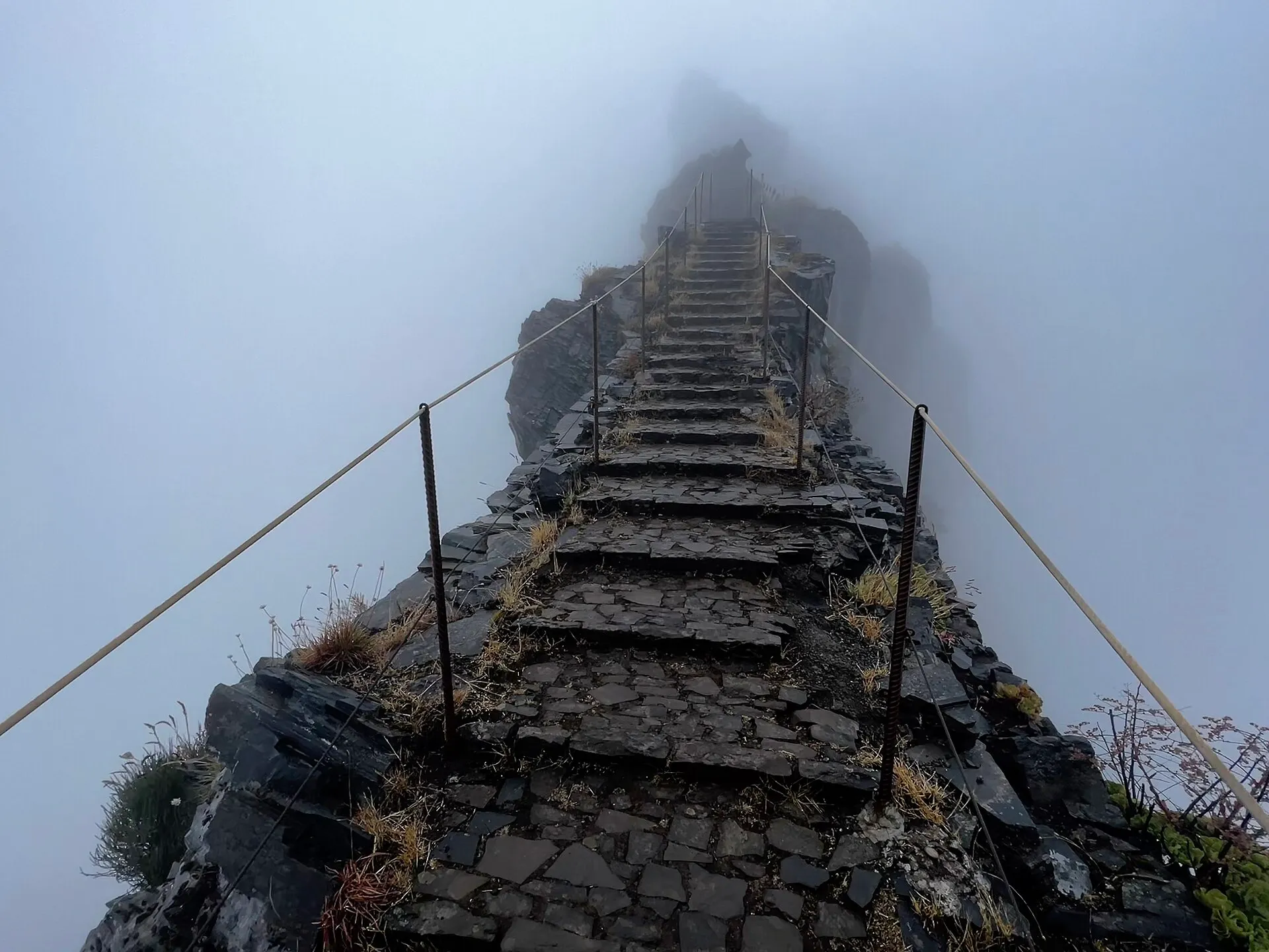
Every levada looks the same on Instagram: a stone path, a channel of clear water, ferns, a waterfall. On the ground they could not be more different. One is a flat stroll a child can manage. Another is a narrow ledge above a long drop with a handrail that comes and goes, and a dark tunnel where your phone light is not enough.
First-timers pick the walk from a picture and find out what it is halfway along. Before you commit to any walk, find four things.
Do I need a licence?
Since 1 January 2026, every classified PR trail needs a booking on SIMplifica, paid in advance and tied to a half-hour entry window. The fee in 2026 is €4.50 per person for most trails; the full PR 1 ridge is €10.50. Residents book but do not pay. Buy it the evening before, not at a trailhead with no signal. Walking without one is an offence: you can be asked to leave the trail and fined. On PR 1 there is a gate at Pedra Rija, and a licence for the short section does not get you through it.
Check the status too. Some trails are closed and some are open only in part, with detours or a section shut. The booking portal only sells trails that are at least partly open, but that does not tell you which part. Visit Madeira and the IFCN publish the current state.
How exposed is it?
Some of the most famous walks have long sheer drops beside the path: the PR 1 ridge, stretches of Caldeirão Verde, parts of the 25 Fontes. If heights bother you, they will bother you there. Start with something forgiving. Chão dos Louros is a 45-minute loop in a forest park with toilets and picnic tables. Balcões at Ribeiro Frio is flat and shaded, about an hour and a half there and back at an easy pace, and ends looking at the peaks.
Are there tunnels?
Plenty of levadas go through the rock. Caldeirão Verde has four unlit tunnels, wet and low. Some tunnels elsewhere run for hundreds of metres. Take a proper torch or headlamp, not your phone, and expect wet feet.
Where does it end?
This is the one that catches people out most. Many Madeira walks are linear. They finish somewhere else, often far below where you started, and the bus, if there is one, runs once a day.
- The Caminho do Norte drops 680 m from Encumeada to São Vicente. The bus back up over Encumeada leaves once a day, at 15:30 from São Vicente. Miss it and it is a taxi or a long climb.
- Beyond Pedra Rija, PR 1 is one way only, from Areeiro towards Pico Ruivo. You end at Pico Ruivo, walk on to Achada do Teixeira and need a taxi back to your car at Areeiro.
- The paved road down to Rabaçal is closed to cars. You park on the ER 105, walk 2 km of tarmac or take the shuttle, and climb back up at the end.
The fix: read the trail page before you book, not after. Every one of ours lists the licence, the exposure, the tunnels and how you get back.
Mistake 3: trusting one forecast
The weather app gives you one symbol for an island with an 1,800 m spine down the middle. It tells you about as much as one symbol would for a whole mountain range anywhere else.
The typical version: blue sky over the hotel pool, so you drive up to Pico do Areeiro and park inside a cloud. The reverse is just as common and more annoying, because you never find out: grey over Funchal, day written off, while the summit sat in sunshine above it all morning.
A few rules of thumb hold most days:
- The peaks are clearest early and cloud over by late morning. That is why people go at sunrise.
- The north coast is wetter than the south. The trade winds pile cloud against the northern cliffs.
- The south-west is the sunniest. Ponta do Sol, sheltered by its headlands, is often in sun when Funchal is not.
- The eastern tip is the driest land on the island, and often clear when the centre is not.
The fix: choose the day’s region that morning, from a webcam of the place itself: the summit at Areeiro, the Rabaçal car park, the coast at Porto Moniz. If it is grey there, go to the other side; there is nearly always a clear coast somewhere. That only works if your plan is a set of days you can shuffle, which is one more reason for mistake 1’s rule. Weather and what to pack has the season-by-season picture.
The short version
Give the island its size. Read the trail, not the photo. Look at the mountain, not the forecast.
The app puts every trail’s licence, closures and way back in one place, and warns you when the IFCN closes a trail you have saved.
Questions people ask
What should I know before my first trip to Madeira?
That the island is slow to cross, so plan one region a day; that classified trails need a booking and a licence bought online; and that the weather changes with altitude and coast, so look at a webcam of where you are going rather than one forecast.
Do I really need to book hiking trails in Madeira?
Yes. Since 1 January 2026 every classified PR trail needs a booking on SIMplifica with a half-hour entry window: €4.50 per person for most trails in 2026, €10.50 for the full PR 1. Residents book but do not pay. Walking without one can get you sent back and fined.
Which levada is best for a first-timer?
Balcões at Ribeiro Frio: flat, shaded, about an hour and a half there and back at an easy pace, with a view of the peaks at the end. Chão dos Louros is shorter still, and a loop.
How long does it take to drive across Madeira?
The expressway makes the south coast quick, but any trip to the north, the peaks or the far west involves tunnels, hairpins and steep side roads. Plan on one region a day, not a loop of the island.
Is the weather in Funchal the same as in the mountains?
Often not. Funchal can be sunny while Pico do Areeiro, 1,818 m up, is inside a cloud, and the reverse happens too. Look at a live webcam of the place itself.